STUDY SITE AND DATA COLLECTION
I. Provenance Data Collection
A literature review was conducted to compile a comprehensive list of Pinus contorta provenance trials conducted across Europe. In total, 12 conference proceedings and technical reports as well as unpublished data from the von Thünen Institut were summarized and used to establish a data set of 72 provenance trial sites with 2039 provenance transfers, each from a unique source to unique test location (Herva et al. 2016). In total, there were ten seed origins used: Boreal, Cascades, Central Coast Wet, Central Coast Dry, Cypress Hills, Northern Coast, Southeast Interior, Southern Coastal, Southern Interior and Sub-Boreal. Duplicate latitude and longitude entries were removed to have one seed transfer represent one provenance site for ARCmap analysis.
A literature review was conducted to compile a comprehensive list of Pinus contorta provenance trials conducted across Europe. In total, 12 conference proceedings and technical reports as well as unpublished data from the von Thünen Institut were summarized and used to establish a data set of 72 provenance trial sites with 2039 provenance transfers, each from a unique source to unique test location (Herva et al. 2016). In total, there were ten seed origins used: Boreal, Cascades, Central Coast Wet, Central Coast Dry, Cypress Hills, Northern Coast, Southeast Interior, Southern Coastal, Southern Interior and Sub-Boreal. Duplicate latitude and longitude entries were removed to have one seed transfer represent one provenance site for ARCmap analysis.
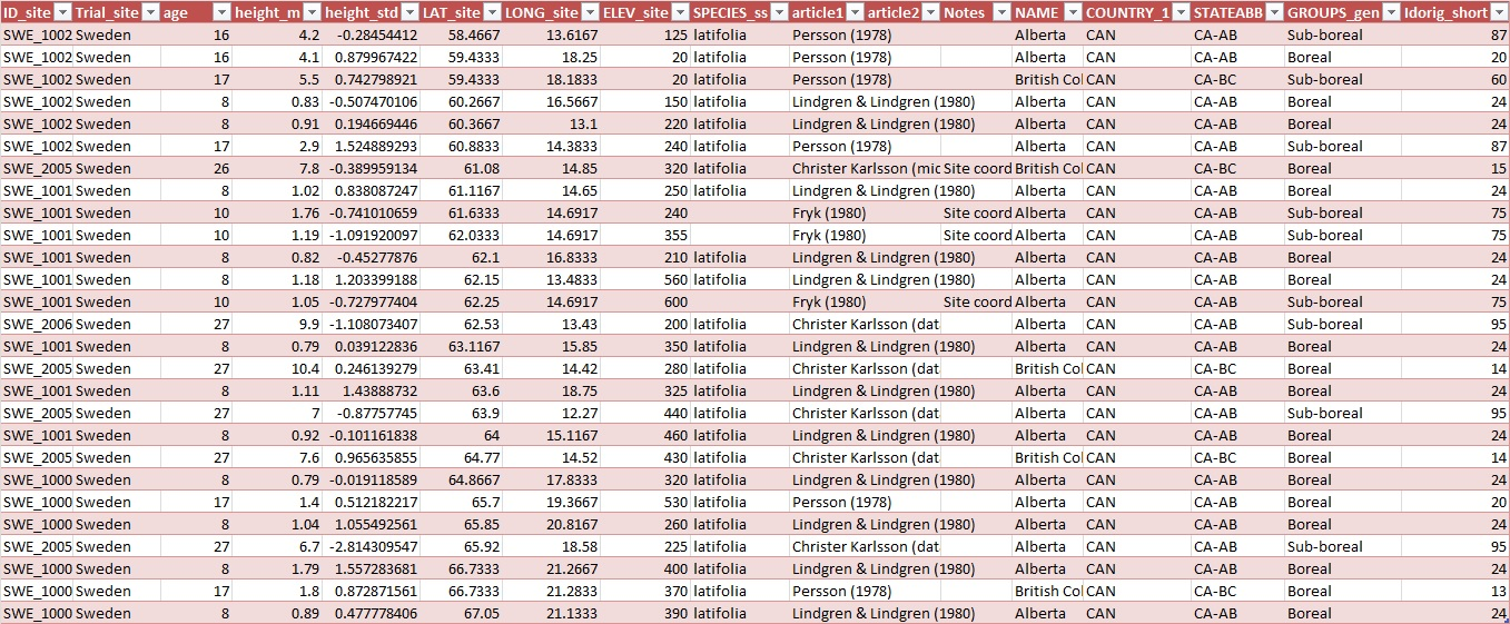
Figure 2: Example of Lodgepole pine provenance trial dataset for Sweden
II. Local Species Data Collection
72 Lodgepole pine provenance trials across Europe were plotted using ArcMap 9.3 . A 300 km buffer zone was created around each point. Growth performance from an extensive European Inventory Database for 5 forestry species (Fagus sylvatica, Picea abies, Pinus sylvestris,Pseudotsuga menziesii, Quercus petraea) were plotted onto the map (Figure 3). Points that were found within each buffer zone were deemed comparable to its' respective provenance trial and extracted for further analysis.
72 Lodgepole pine provenance trials across Europe were plotted using ArcMap 9.3 . A 300 km buffer zone was created around each point. Growth performance from an extensive European Inventory Database for 5 forestry species (Fagus sylvatica, Picea abies, Pinus sylvestris,Pseudotsuga menziesii, Quercus petraea) were plotted onto the map (Figure 3). Points that were found within each buffer zone were deemed comparable to its' respective provenance trial and extracted for further analysis.
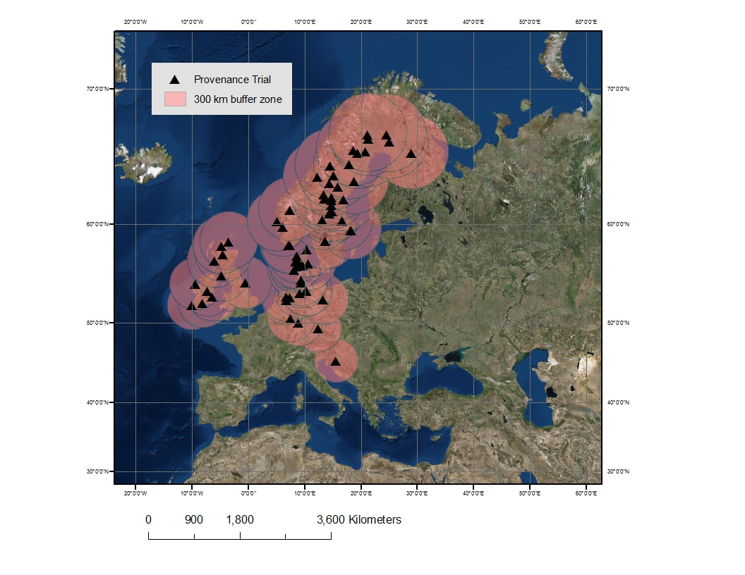
Figure 3: Map of 72 Lodgepole pine provenance trials in Europe with a 300km buffer
The local species growth data extracted from the ArcGIS layer were separated by country and by species. Observed local species for Sweden were Picea abies and Pinus sylvestris. Observed local species for Germany included: Fagus sylvatica, Picea abies, Pinus sylvestris, Pseudotsuga menziesii, Quercus petraea. All five are strong forestry species in their respective countries and were used to determine a local growth performance reference for Pinus contorta. Age and mean height were plotted for each species to check for any outliers in the data.
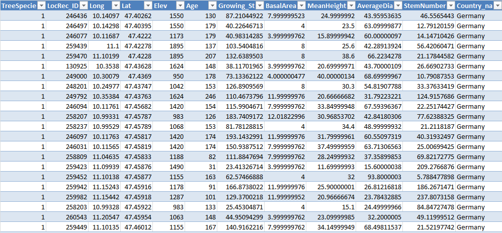
Figure 4: Example of European Inventory dataset for Germany and Species 1 (Albies abies)
